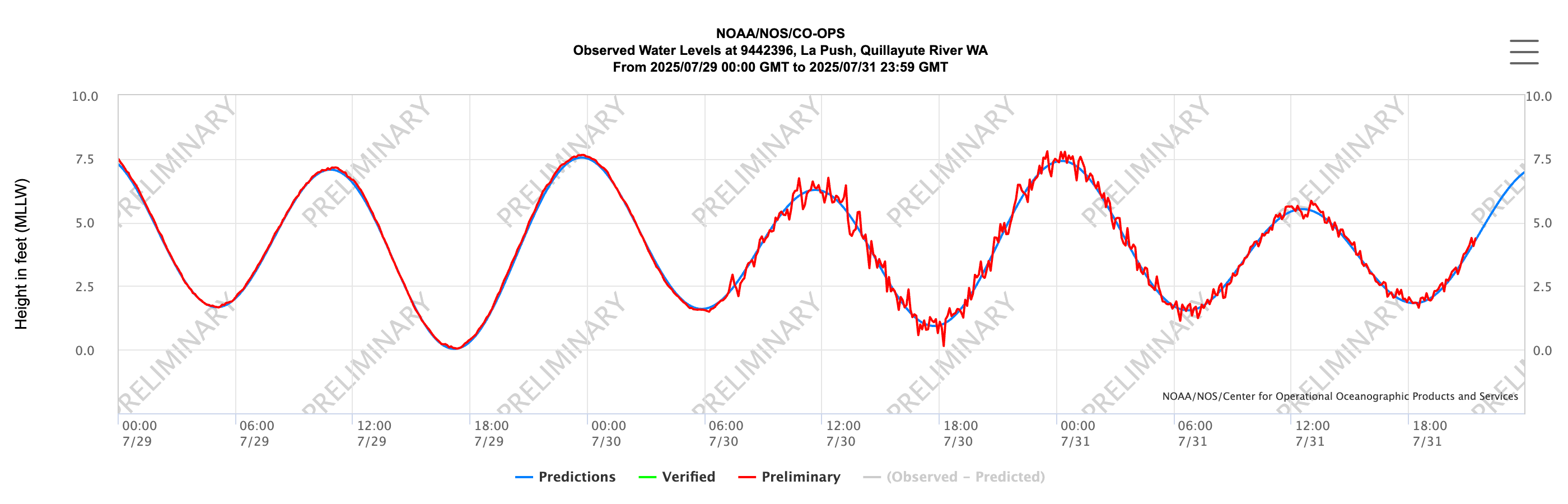
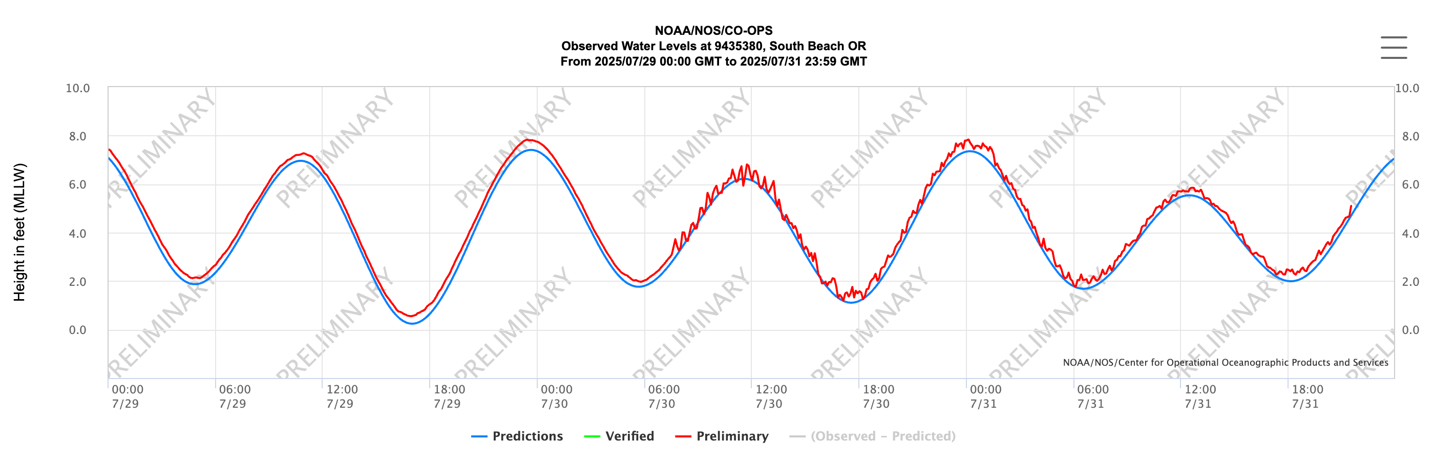
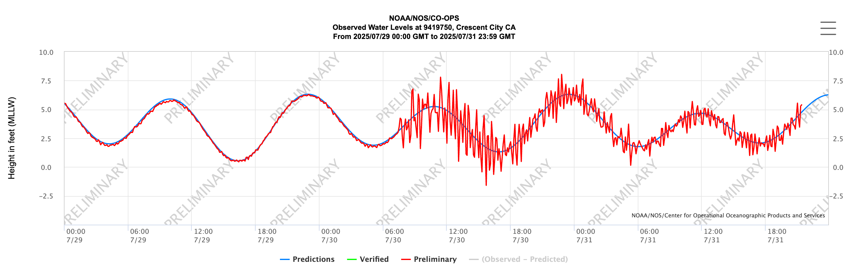
 | Tsunami Arrived in PNW Curious about how the tsunami waves look? We see very different signatures depending on location. This is due to the geomorphology of the harbors and other factors. Click on the buttons below to view water levels for select regional sites, thanks to NOAA NOS. We appreciate that so many of you are using the NVS Tsunami Evac app. If you haven’t already, plot your evacuation route now, so you know it. Be aware that we pass along the bulletins created by the U.S. Tsunami Warning System. We do not create or filter tsunami bulletins, as the U.S. Tsunami Warning System is the authority for tsunami events. But use our app to find your safest evacuation route! 30 Jul 2025 |
| National Observing System Partners Alliance for Coastal Technologies (ACT) Southeastern Universities Research Association (SURA) Integrated Ocean Observing System IOOS | |||||||